Archivo:1841 map of the Oregon Territory.jpg
De LibreFind
No disponible en mayor resolución.
1841_map_of_the_Oregon_Territory.jpg (322 × 218 píxeles; tamaño de archivo: 23 KB; tipo MIME: image/jpeg)
| Descripción |
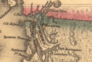
English: Map of the Oregon Country. Shows boundary on the 54° 40' line near Fort Simpson |
| Fecha | |
| Fuente | [1] |
| Autor | U.S. Ex. Ex., Charles Wilkes, Esqr., Commander |

Resumen
Este archivo está en el dominio público en los Estados Unidos. Esto se aplica a los trabajos de Estados Unidos donde los derechos de autor han expirado, a menudo porque su primera publicación ocurrió antes del 1 de enero de 1929. Véase esta página para explicación adicional.
|
 | |
 |
Esta imagen puede estar protegida fuera de los Estados Unidos —especialmente en Canadá, China (excepto Hong-Kong, Macao, o el área de Taiwán), Alemania o Suiza—. El creador y el año de publicación son información esencial y deben ser proporcionados. Véase Wikipedia:Derechos de autor para más detalles.
|
Historial del archivo
Haz clic sobre una fecha/hora para ver el archivo a esa fecha.
| Fecha y hora | Miniatura | Dimensiones | Usuario | Comentario | |
|---|---|---|---|---|---|
| actual | 00:38 11 abr 2006 | | 322 × 218 (23 KB) | Roke~commonswiki | Map of the Oregon Territory / by the U.S. Ex. Ex., Charles Wilkes, Esqr., Commander, 1841. [http://memory.loc.gov/cgi-bin/query/r?ammem/gmd:@field(NUMBER+@band(g4240+ct000908))] Shows boundary on the 54 40' line {{PD-US}} Historical maps of Canada |
Usos del archivo
La siguiente página enlaza a este archivo: