Archivo:Aerial view of Nauru.jpg
De LibreFind
Tamaño de esta previsualización: 800 × 587 píxeles. Otras resoluciones: 320 × 235 píxeles | 640 × 469 píxeles | 1024 × 751 píxeles | 1280 × 938 píxeles | 1600 × 1173 píxeles.
Archivo original (1600 × 1173 píxeles; tamaño de archivo: 545 KB; tipo MIME: image/jpeg)
Resumen
| Descripción |
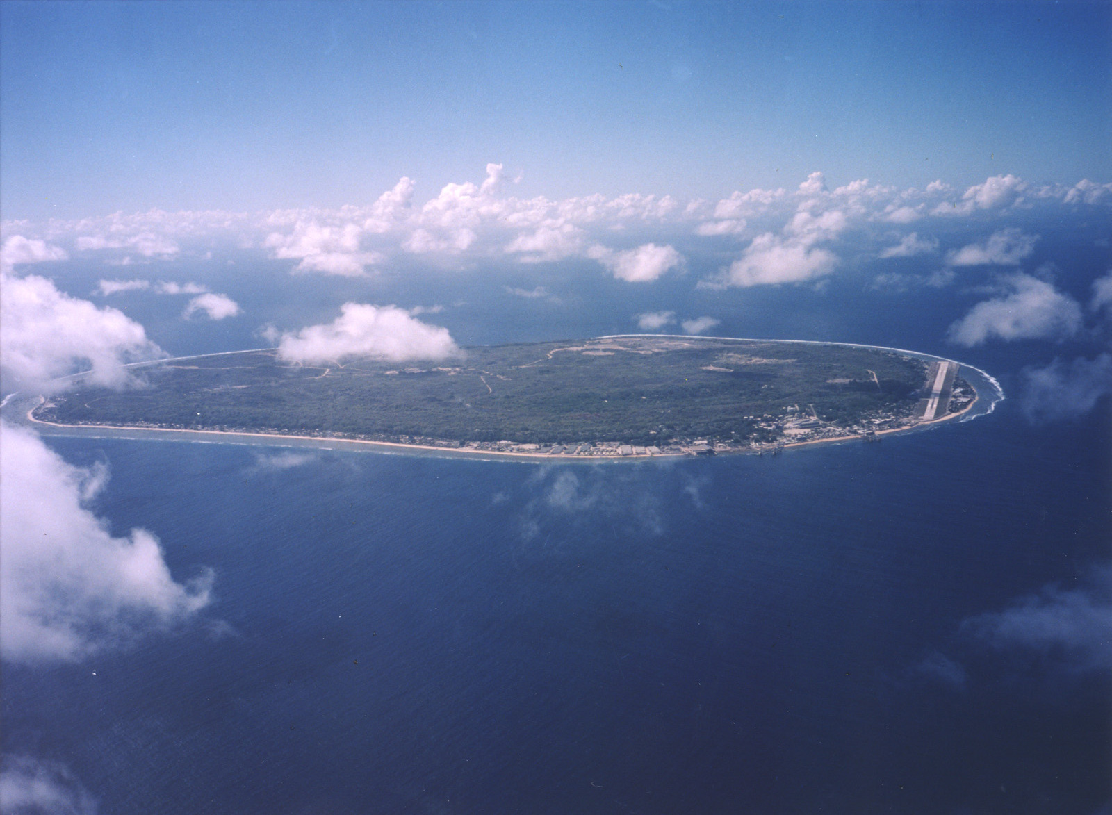
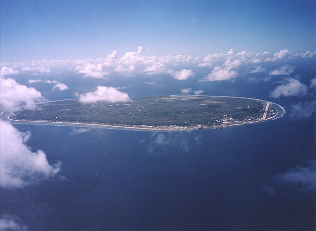
English: A limestone karst on Nauru Island as a result of the over-mining of phosphate. |
| Fecha | |
| Fuente | https://www.flickr.com/photos/armgov/4708951747/ |
| Autor | U.S. Department of Energy's Atmospheric Radiation Measurement Program |
Licencia
This photograph was produced by the Atmospheric Radiation Measurement Program.
Their site states:
|
Historial del archivo
Haz clic sobre una fecha/hora para ver el archivo a esa fecha.
| Fecha y hora | Miniatura | Dimensiones | Usuario | Comentario | |
|---|---|---|---|---|---|
| actual | 00:53 29 abr 2023 | | 1600 × 1173 (545 KB) | Auguel | Cropped 1 % vertically using CropTool with lossless mode. |
Usos del archivo
La siguiente página enlaza a este archivo: