Archivo:TOMS indonesia smog lrg.jpg
Resumen
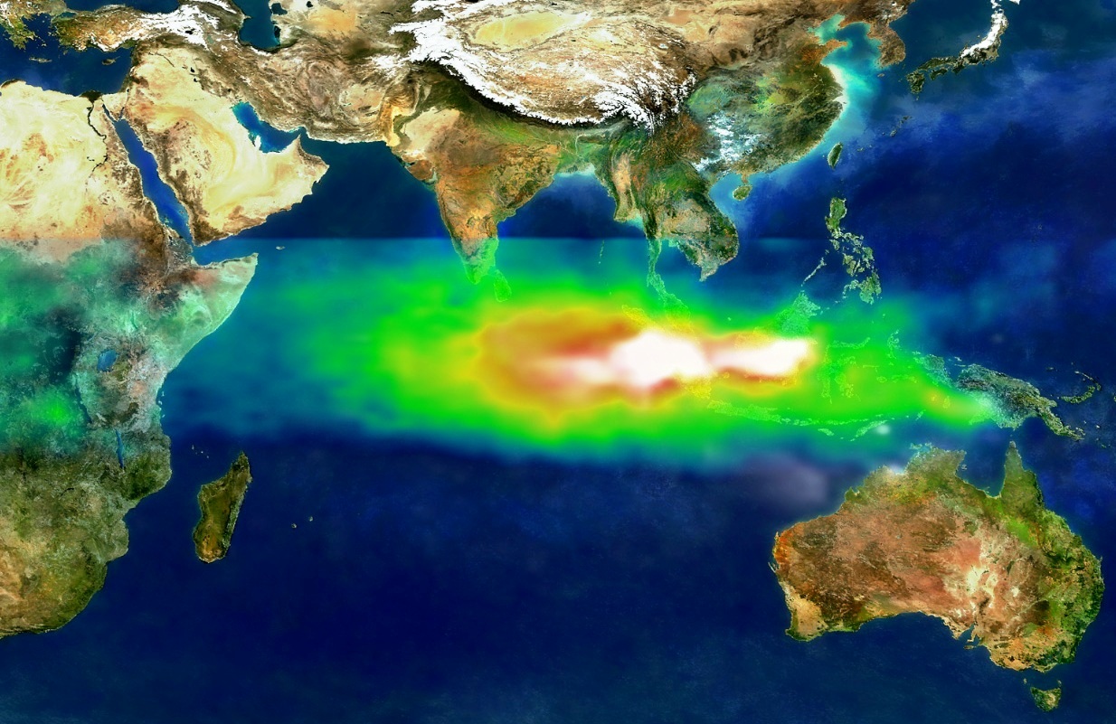
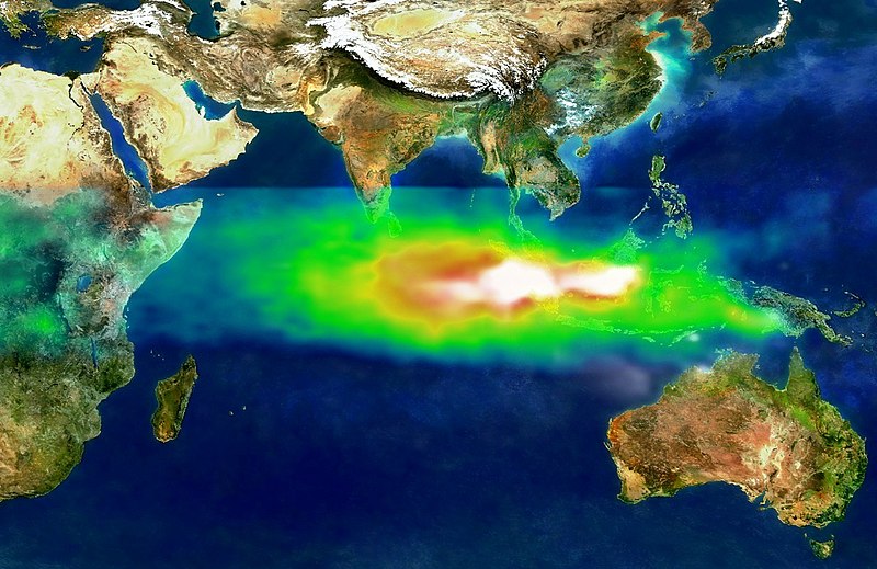
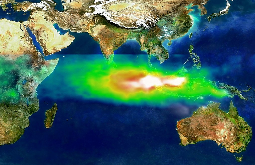
This image shows the pollution over Indonesia and the Indian Ocean on October 22, 1997. White represents the aerosols (smoke) that remained in the vicinity of the fires. Green, yellow, and red pixels represent increasing amounts of tropospheric ozone (smog) being carried to the west by high-altitude winds.
Researchers have discovered that smoke and smog move in different ways through the atmosphere. A series of unusual events several years ago created a blanket of pollution over the Indian Ocean.
In the second half of 1997, smoke from Indonesian fires remained stagnant over Southeast Asia while smog, which is tropospheric, low-level ozone, spread more rapidly across the Indian Ocean toward India.
Researchers tracked the pollution using data from NASA's Earth Probe Total Ozone Mapping Spectrometer (TOMS) satellite instrument. "TOMS is the only satellite instrument that follows both smoke and smog, globally," said Anne Thompson, NASA Earth Scientist at Goddard Space Flight Center, Greenbelt, MD. "The extreme pollution generated during the Indonesian fires was the first time we saw smoke move more slowly and in different directions from where smog moved."
http://visibleearth.nasa.gov/view_rec.php?id=1651
Licencia
| Este archivo es de dominio público porque fue creado por la NASA. Las políticas sobre copyright de la NASA estipulan que «el material de la NASA no está protegido con copyright a menos que se indique lo contrario». (Políticas sobre copyright de la NASA o Políticas sobre la utilización de imágenes del Jet Propulsion Laboratory). | ||
 |
Advertencias:
|
Historial del archivo
Haz clic sobre una fecha/hora para ver el archivo a esa fecha.
| Fecha y hora | Miniatura | Dimensiones | Usuario | Comentario | |
|---|---|---|---|---|---|
| actual | 12:18 12 sep 2013 | | 1234 × 801 (337 KB) | Soerfm | Crop, contrast |
Usos del archivo
La siguiente página enlaza a este archivo: