Archivo:Floyd flood map.jpg
De LibreFind
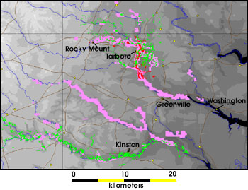
Floyd_flood_map.jpg (350 × 269 píxeles; tamaño de archivo: 35 KB; tipo MIME: image/jpeg)
Historial del archivo
Haz clic sobre una fecha/hora para ver el archivo a esa fecha.
| Fecha y hora | Miniatura | Dimensiones | Usuario | Comentario | |
|---|---|---|---|---|---|
| actual | 09:01 31 ene 2006 |  | 350 × 269 (35 KB) | Jdorje~commonswiki | his flood map shows a comparison of the flood data collected by AVHRR (pink pixels), Radarsat (red pixels), and Landsat 7 (green pixels). These colors show areas that were flooded in the wake of Hurricane Floyd. Due to interference from clouds and forest |
Usos del archivo
La siguiente página enlaza a este archivo:


