Archivo:Powder-River-Map.jpg
De LibreFind
Powder-River-Map.jpg (412 × 444 píxeles; tamaño de archivo: 130 KB; tipo MIME: image/jpeg)
Historial del archivo
Haz clic sobre una fecha/hora para ver el archivo a esa fecha.
| Fecha y hora | Miniatura | Dimensiones | Usuario | Comentario | |
|---|---|---|---|---|---|
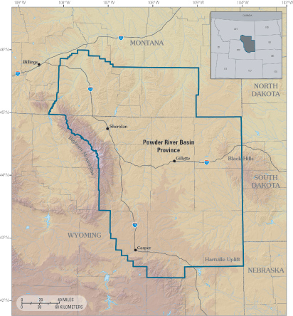
| actual | 01:24 14 may 2007 |  | 412 × 444 (130 KB) | Dual Freq | {{Information |Description=Powder River Basin Province of northeastern Wyoming and southeastern Montana. |Source=http://pubs.usgs.gov/fs/fs-146-02/Powder-River-Map.jpg from http://pubs.usgs.gov/fs/fs-146-02/fs-146-02.html |Date=Unknown |Author=USGS |Permi |
Usos del archivo
La siguiente página enlaza a este archivo:

