Archivo:Westbourne-route-1790.jpg
De LibreFind

Tamaño de esta previsualización: 293 × 599 píxeles. Otras resoluciones: 117 × 240 píxeles | 393 × 804 píxeles.
Archivo original (393 × 804 píxeles; tamaño de archivo: 108 KB; tipo MIME: image/jpeg)
Historial del archivo
Haz clic sobre una fecha/hora para ver el archivo a esa fecha.
| Fecha y hora | Miniatura | Dimensiones | Usuario | Comentario | |
|---|---|---|---|---|---|
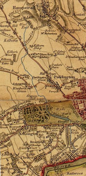
| actual | 20:37 5 feb 2010 |  | 393 × 804 (108 KB) | Switch199 | {{Information |Description={{en|1=Route of the River Westbourne (highlighted in blue) shown between West End (now known as West Hampstead) and the Thames on a 1790 map.}} |Source=Crop of US Library of Congress scan of 1790 map by Faden, William http://hdl |
Usos del archivo
La siguiente página enlaza a este archivo:
